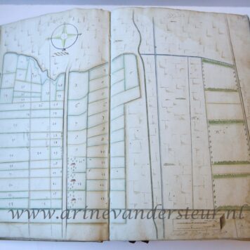
[Antique print, etching] Plan of the siege of Tournai in 1709 (Spanish Succession War), published 1729.
SKU: PR120723
Large plano on two sheets joined together, total: 692x 820 mm; wide margins, two vertical folding creases and one horizontal towards the bottom. A small hole on one intersection of folding creases, otherwise in great condition.


![[Antique print, etching] Plan of the siege of Tournai in 1709 (Spanish Succession War), published 1729.](https://arinevandersteur.nl/wp-content/uploads/PR120723_1-scaled-1.jpg "[Antique print, etching] Plan of the siege of Tournai in 1709 (Spanish Succession War), published 1729")
![[Antique print, etching] Plan of the siege of Tournai in 1709 (Spanish Succession War), published 1729.](https://arinevandersteur.nl/wp-content/uploads/PR120723_4-scaled-1.jpg "[Antique print, etching] Plan of the siege of Tournai in 1709 (Spanish Succession War), published 1729")
![[Antique print, etching] Plan of the siege of Tournai in 1709 (Spanish Succession War), published 1729.](https://arinevandersteur.nl/wp-content/uploads/PR120723_3-scaled-1.jpg "[Antique print, etching] Plan of the siege of Tournai in 1709 (Spanish Succession War), published 1729")
![[Antique print, etching] Plan of the siege of Tournai in 1709 (Spanish Succession War), published 1729.](https://arinevandersteur.nl/wp-content/uploads/PR120723_2-scaled-1.jpg "[Antique print, etching] Plan of the siege of Tournai in 1709 (Spanish Succession War), published 1729")
![[Antique print, etching] Plan of the siege of Tournai in 1709 (Spanish Succession War), published 1729.](https://arinevandersteur.nl/wp-content/uploads/PR120723_1-scaled-1-356x356.jpg)
![[Antique print, etching] Plan of the siege of Tournai in 1709 (Spanish Succession War), published 1729.](https://arinevandersteur.nl/wp-content/uploads/PR120723_4-scaled-1-356x356.jpg)
![[Antique print, etching] Plan of the siege of Tournai in 1709 (Spanish Succession War), published 1729.](https://arinevandersteur.nl/wp-content/uploads/PR120723_3-scaled-1-356x356.jpg)
![[Antique print, etching] Plan of the siege of Tournai in 1709 (Spanish Succession War), published 1729.](https://arinevandersteur.nl/wp-content/uploads/PR120723_2-scaled-1-356x356.jpg)
![[Antique prints, etchings, 1639] Six marines [Eight Marines; set title]/Zes schepen, published 1639, 6 pp.](https://arinevandersteur.nl/wp-content/uploads/59853_7-scaled-1-356x356.jpg)
![[Antique prints, etchings, 1639] Six marines [Eight Marines; set title]/Zes schepen, published 1639, 6 pp.](https://arinevandersteur.nl/wp-content/uploads/59853_8-scaled-1-356x356.jpg)
![[Antique print, etching] Barkentijn Zeylende by de wind; Verscheide soorten Hollandse schepen - E (serie title), published ca 1826, 1 p.](https://arinevandersteur.nl/wp-content/uploads/59743_1-scaled-1-356x356.jpg)

![[Antique print, etching] Koopvaardy - buys Zeijlende bij de wind; Verscheide soorten Hollandse schepen - E (serie title), published ca 1826, 1 p.](https://arinevandersteur.nl/wp-content/uploads/59741_1-scaled-1-356x356.jpg)

![[Antique print, etching, 1749] Map of Spain and Portugal, published ca. 1749.](https://arinevandersteur.nl/wp-content/uploads/PR120725_1-scaled-1-100x100.jpg)
![[Antique print, etching] Map of the siege of Saint-Venant in 1710 (Spanish Succession War), published 1729.](https://arinevandersteur.nl/wp-content/uploads/PR120722_1-scaled-1.jpg)