Harrewijn, J.
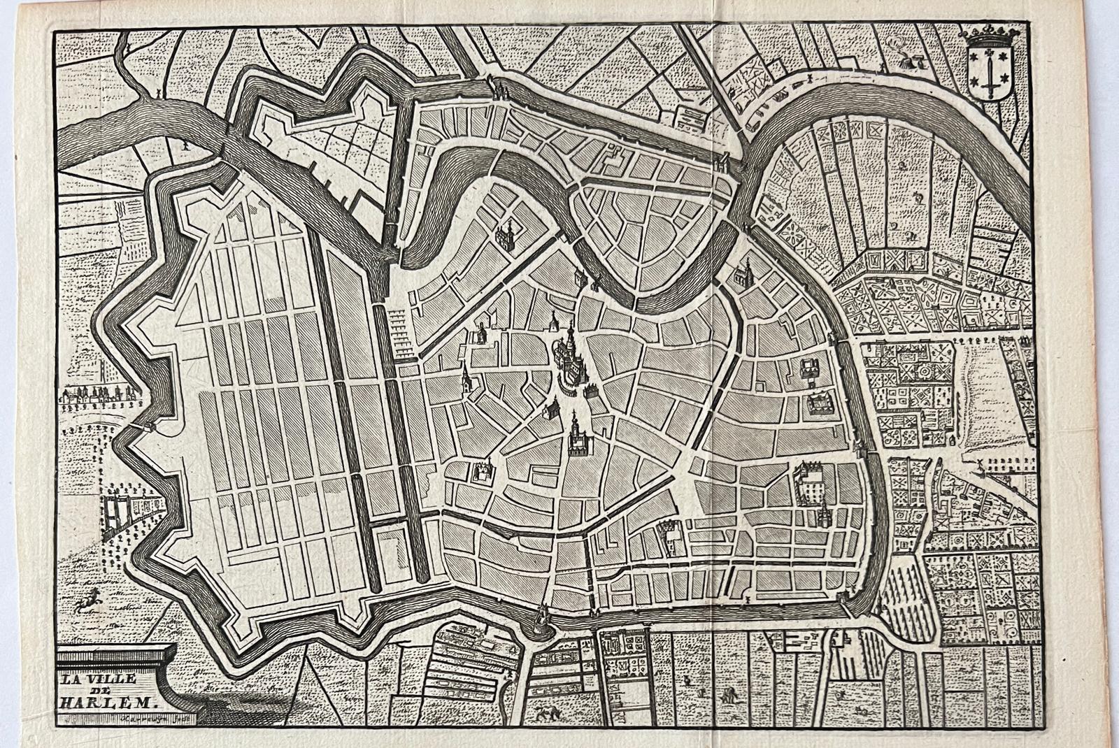
Cartography Haarlem 1720 | Antique map of Haarlem. Plattegrond met stadswapen van Haarlem “La ville de Harlem”. Date of print: ca 1720. With gardens and land on the outside of the city wall.
Antique map of Haarlem. Plattegrond met stadswapen van Haarlem “La ville de Harlem”. Date of print: ca 1720.
View of city of Haarlem. On the left bottom the text “La ville de Harlem”. On the right top coat of arms of Haarlem (Stadwapen van Haarlem). Kopergravure van Haarlem, verschenen in: “Histoire Generale des Pais bas Contenant la Description des XVII Provinces”. Uitgegeven door Francois Foppens. Brussel 1720.
Copper engraving on laid paper. Print in good condition, three vertical folds on the print. Total: 160 x 215 mm.
Prenten, Categorieën, Cartografie, Topografie, Haarlem Prints, Categories, Cartography, Topography, Art, Prints & Posters
SKU: 67130
€ 72,60(€ 60,00




![[Antique print, etching] Het Huis te Kleef, J. van de Velde, published 1615, 1 p.](https://arinevandersteur.nl/wp-content/uploads/60583_01-356x356.jpeg)
![[Antique print, engraving, 1596] Portrait of poet Rutgaert Jansz/Portret van de dichter Rutgaert Jansz., published 1596, 1 p.](https://arinevandersteur.nl/wp-content/uploads/WhatsApp-Image-2022-10-10-at-8.02.08-PM-356x356.jpeg)
![[Antique print, engraving, 1596] Portrait of poet Rutgaert Jansz/Portret van de dichter Rutgaert Jansz., published 1596, 1 p.](https://arinevandersteur.nl/wp-content/uploads/WhatsApp-Image-2022-10-10-at-8.04.07-PM-356x356.jpeg)