

![[Map Rhine folding to 193 cm long river view, 1825] Panorama des Rheins von Mainz bis Cöln. Delkeskamp, Original-ausgabe, Friedrich Wilmans, Frankfurt, 32 pp text in german and french + panorama (193 x 23 cm), 1825.](https://arinevandersteur.nl/wp-content/uploads/WhatsApp-Image-2022-05-28-at-4.04.21-PM-2.jpeg)
![[Map Rhine folding to 193 cm long river view, 1825] Panorama des Rheins von Mainz bis Cöln. Delkeskamp, Original-ausgabe, Friedrich Wilmans, Frankfurt, 32 pp text in german and french + panorama (193 x 23 cm), 1825.](https://arinevandersteur.nl/wp-content/uploads/WhatsApp-Image-2022-05-28-at-4.04.21-PM-3-356x356.jpeg)
Out of stock
Delkeskamp, Friedrich Wilhelm.
ZZ90405-007
€ 196,20 (€ 180,00 ex. btw)
![[Map Hannover, Germany, special folding way] Stadtplan der landeshauptstadt Hannover, Hamburger Kreditbank aktiengesellschaft in Hangover rathenauplatz 4, hinter dem Opernhaus, kaart.](https://arinevandersteur.nl/wp-content/uploads/WhatsApp-Image-2022-05-28-at-3.37.07-PM.jpeg)
![[Map Hannover, Germany, special folding way] Stadtplan der landeshauptstadt Hannover, Hamburger Kreditbank aktiengesellschaft in Hangover rathenauplatz 4, hinter dem Opernhaus, kaart.](https://arinevandersteur.nl/wp-content/uploads/WhatsApp-Image-2022-05-28-at-3.42.35-PM-3.jpeg)
[Map of Hannover]
ZZ90405-008
€ 54,50 (€ 50,00 ex. btw)
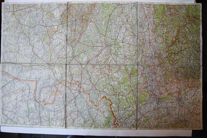
![[Switserland, Schweiz, 1923] Topographischer Atlas der Schweiz, 1:50000, Scheidegg, Schweiz. Landestopographie, Bern, Kaart, 93 x 78 cm.](https://arinevandersteur.nl/wp-content/uploads/WhatsApp-Image-2022-05-28-at-3.33.38-PM-2.jpeg)
![[Switserland, Schweiz, 1923] Topographischer Atlas der Schweiz, 1:50000, Scheidegg, Schweiz. Landestopographie, Bern, Kaart, 93 x 78 cm.](https://arinevandersteur.nl/wp-content/uploads/WhatsApp-Image-2022-05-28-at-3.33.38-PM.jpeg)
[Map of Zwitserland]
ZZ90405-009
€ 21,80 (€ 20,00 ex. btw)
![[Antique print; cartography/cartografie] Mansfeld, Germany, published 1696.](https://arinevandersteur.nl/wp-content/uploads/PR120640_1-scaled-1-356x356.jpg)
Gerard Valck (1651-1726) and Pieter Schenk (1660-1713), after Pieter van den Berge (1659-1737), after Tilemann Stella (1525-1589)
PR120640
€ 302,50 (€ 250,00 ex. btw)
![[Antique print; cartography/cartografie] The states of Savoy, Piedmont and Nice, published ca. 1700.](https://arinevandersteur.nl/wp-content/uploads/PR120639_1-scaled-1-356x356.jpg)
Pieter Schenk (1660-1713) after Nicolas Sanson (1600-1667)
PR120639[Antique print; cartography/cartografie] The states of Savoy, Piedmont and Nice, published ca. 1700.
€ 423,50 (€ 350,00 ex. btw)
![[History Scheveningen, The Hague 1890] La plage de Schéveningue, Dessins de La Haye. M.M. Couvee, [ca. 1890].](https://arinevandersteur.nl/wp-content/uploads/WhatsApp-Image-2021-04-19-at-10.39.01-6-356x356.jpeg)
![[History Scheveningen, The Hague 1890] La plage de Schéveningue, Dessins de La Haye. M.M. Couvee, [ca. 1890].](https://arinevandersteur.nl/wp-content/uploads/WhatsApp-Image-2021-04-19-at-10.39.10-3-356x356.jpeg)
Scheidel, J.L.,
52606
€ 430,55 (€ 395,00 ex. btw)
![[City map/Cartography] Afbeelding naar het best Origineel, van de Stad Batavia, en hoe het verraad der Chineesen op de zelve, door de Europiaanen is verydeld geworden. op den 8sten October etc. des Jaars 1740. / The uprising of the Chinese in Batavia on the 8th October 1740, published ca 1741.](https://arinevandersteur.nl/wp-content/uploads/65830_1-scaled-1.jpg)
Out of stock
Anonymous artist
65830
€ 96,80 (€ 80,00 ex. btw)
ANTHONISZOON,CORNELIS. Gouw,J.Ter.
65127
€ 218,00 (€ 200,00 ex. btw)
![[Cartography/cartografie] The kingdom of Naples, 1786/Het koninkrijk Napels 1786.](https://arinevandersteur.nl/wp-content/uploads/65916_1-scaled-1.jpg)
'---
65916
€ 423,50 (€ 350,00 ex. btw)
![[Cartography/cartografie] Plan de Batavia [from: "L' Atlas curieux, ou Le monde réprésenté dans des cartes générales et particulieéres du ciel et de la terre"]/Kaart van Batavia (nu Jakarta).](https://arinevandersteur.nl/wp-content/uploads/65915_1-scaled-1.jpg)
Out of stock
de Fer, Nicolas (1646-1720)
65915
€ 145,20 (€ 120,00 ex. btw)
![[Hand colored etching and engraving/handgekleurde ets en gravure kaart van Italië] L'ITALIE (map of Italy).](https://arinevandersteur.nl/wp-content/uploads/65902_1-scaled-1.jpg)
after Riccioli, Giovanni Battista (1598-1671)
65902
€ 459,80 (€ 380,00 ex. btw)
Kavel met 4 kaarten van Duitsland - jaartallen onbekend
65130
€ 43,60 (€ 40,00 ex. btw)