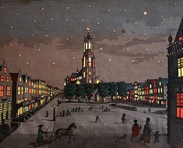
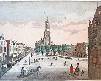
[Antique print, cartography, handcolored engraving] Map of Western Germany, Palatinus Rheni, published ca. 1702.
SKU: PR120641
Handcolored engraving on paper, with some margin; plate mark: 495 x 584 mm, total: 532 x 635 mm; In passepartout total 650 x 750 mm. Some staining along the margins, corners slightly damaged; otherwise in very good condition. Two binding holes on the left margins; a vertical folding crease at center.


![[Antique print, cartography, handcolored engraving] Maps of Western Germany, published ca. 1702.](https://arinevandersteur.nl/wp-content/uploads/PR120641_1-scaled-1.jpg "[Antique print, cartography, handcolored engraving] Maps of Western Germany, published ca. 1702")

![[Antique handcolored engraving, 1774] AFBEELDING van den NIEUWEN AMSTERDAMSCHEN SCHOUWBURG, van vooren/ Gezicht op de voorkant van de nieuwe Amsterdamse Schouwburg op het Leidseplein, published 1774, 1 p.](https://arinevandersteur.nl/wp-content/uploads/WhatsApp-Image-2022-10-10-at-7.33.22-PM-356x356.jpeg)

![[Antique print, cartography, woodcut] SVEVIAE ET BAVARIAE DESCRIPTIO [Cosmographia Universalis], published 1550.](https://arinevandersteur.nl/wp-content/uploads/PR120642_1-scaled-1-100x100.jpg)
![[Antique print; cartography/cartografie] Mansfeld, Germany, published 1696.](https://arinevandersteur.nl/wp-content/uploads/PR120640_1-scaled-1-100x100.jpg)